Often referred to as Portugal’s answer to Route 66, the Estrada Nacional 2 is the country’s most iconic road, winding its way the entire length of the country from the ancient city of Chaves to Faro, on the balmy southern coast of the Algarve.
Cutting right through the centre of this beautiful country, the N2 gives us a chance to explore a side of Portugal that is often ignored by visitors, who favor the coastal big cities and sunny beach resorts. We’ll pass through untouched mountain ranges, the stunning Douro Valley wine region, UNESCO World Heritage sites, spectacular lakes, and a host of historic villages and towns.
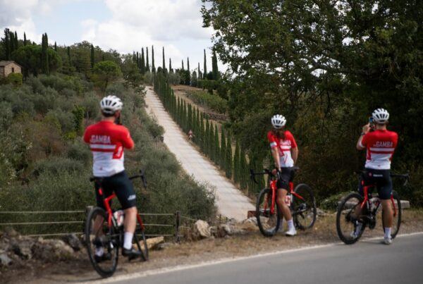
And you’ll be in the best of hands along the way because most of the inGamba team of soigneurs and mechanics call Portugal home. This special randonnée is an opportunity to share their intimate knowledge and discover one of the world’s most charming and unique destinations.
Stage 1
CHAVES – REGUA
Distance » 92 km
Elevation » 1,522m
We’ll set out on undulating terrain, before hitting the first big climb of the day between Vidago and the quaint spa town of Sabroso de Aguiar. It’s just under 7km long and averages a gentle grade of 3.2%, but there will be several more to come throughout the day as we skirt the edges of the Serra do Alvão mountains. The ride’s highest point comes around kilometer 49, just before Vilarinho de Samardã, and is followed by a long descent to Vila Real. The final 30km is on the kind of terrain we like to call “Portuguese rollers,” and will take us home to the beautiful vineyard of Quinta da Pacheca in the Douro Valley.
Stage 2
REGUA – TONDELA
Distance » 136 km
Elevation » 2,209 m
Suitably warmed up after our opening ride, day 2 is a little more challenging and opens with a big climb right out of the gate. Lasting 29km and gaining 952m in elevation, it brings us to the village of Bigorne, which at just under 1,000m above sea level is the highest point of the trip. That’s quickly followed by a 10km descent to Castro Daire, after which you’ll have 60km of rolling roads to look forward to before we arrive at our new base in the Caramulo Mountains, with a couple of longer climbs thrown in for good measure.
Stage 3
TONDELA – SERTĀ
Distance » 115 km
Elevation » 2,086 m
Only the third-longest day in terms of pure distance, this is definitely the toughest of the week with more 2,200 meters of climbing packed into the 137km route. There are a few short climbs peppered across the first half of the day, but the real business begins after 70km, around the town of Góis, where a 14km climb awaits us. At the summit we’ll have a little over 50km still to go, including a couple of long and technical descents on the kind of twisty, quiet roads that cycling dreams are made
Stage 4
SERTĀ – MONTARGIL
Distance » 106 km
Elevation » 1,256 m
Leaving Sertã behind us, day 4 starts out with three climbs in quick succession, each a little harder than the last. The terrain around here isn’t very high, but don’t let the altitude fool you because this part of Portugal is anything but flat and with a total of 1,256m gain to get through, we’ll be going up and down all day as we cross the threshold into the Alentejo region, which literally translates to “Beyond-the-Tagus,” after the river that bisects Portugal and flows out to sea through its capital, Lisbon. This sparsely populated region is Portugal’s breadbasket and the landscape is a tapestry of oak trees, olive orchards and vineyards.
Stage 5
MONTARGIL – FERREIRA DO ALENTEJO
Distance » 163 km
Elevation » 1,521 m
The longest day of the trip is jam packed full of those Portugeuse rollers, so you can expect undulating terrain and leg-sapping little ramps from start to finish as we head deeper into Alentejo. This region produces almost half of all the wine made in Portugal, and in some neat synergy, it’s also the largest producer of cork in the world. Expect plenty of little historic towns and panoramic views across the unspoiled countryside before we arrive in the gorgeous town of Ferreira do Alentejo.
Stage 6
FERREIRA DO ALENTEJO – FARO
Distance » 149 km
Elevation » 1,645 m
Rolling terrain for most of the ride on our final day, but be sure to keep plenty in the tank because there will be a series of tough little climbs after kilometer 84. The last climb of the day tops out at 580m – and promises a glorious descent to our finish line in Faro, on Portugal’s southernmost shore. We’ll end our ride right in the heart of the city, by the Faro Marina, overlooking the Gulf of Cádiz.


